

This walk: 2011-6-15. Merripit Hill, RAF Radio Direction Finding Station, Stannon House, Stannon Great Newtake, Assycombe Hill, Birch Tor & Vitifer Mine Leat, pound, cist, whortleberries, slug, Lady's Bedstraw / Heath Bedstraw, stone row, lousewort, cross-leaved heath.
Walk details below - Information about the route etc.
Concrete base of a building of some sort that was part of the war-time aircraft navigation beam system - RAF Radio Direction Finding Station.
More information being passed about war-time Postbridge, the requisitioning of land for training and live ammunition firing etc. There are still fox holes, shell and mortar craters between Stannon and Ringhill.
A possible cairn? Or a buried bunker?
Concrete base of a Radio Direction Finding Station tower on Merripit Hill. These sent radio signals to aircraft to aid navigation. Rain on camera lens.
Smile, you're on candid camera!
Somewhere over there is Stannon Tor, she said! Possibly it was the high-point to the left, off camera?
Assycombe Hill, peeping out of the mist.
Birch Tor & Vitifer Mine leat.
Stannon house, said to be a occupied by a member of the Rolling Stones in the 1970's and used as a retreat for the group. The lounge was used as a recording studio. The house is more or less surrounded by Stannon Great Newtake and was built at the end of the 18th Century by John & Thomas Hullit after they decided to build a starch factory. The start=ch was to come from potatoes grown in lazy beds that were probably never built. In 1995, the Duchy sold the lease by auction.
Across the valley: an old pound at SX 6487 8161.
Stannon Newtake East cairn and cist: SX 6545 8108. Butler Vol. II (1991) p168.
The cist.
Whortleberries, also called bilberries and "urtz" (Dartmoor dialect), Vaccinium myrtillus - complete with rain drops.
Black slug in the rain .....
In case you missed the previous photograph!
Moor Strollers at the cist.
The cist is close to a double banked ditch (according to Butler) or leat.
Low cloud lifting to reveal Assycombe Hill again.
It suddenly became a "blue sky day"!
Stannon House again.
Lady's Bedstraw (Galium verum) - not to be confused with Northern Bedstraw, Hedge Bedstraw, Heath Bedstraw, Slender Bedstraw, March Bedstraw, Pond Bedstraw, Fen Bedstraw, Wall Bedstraw, or Corn Bedstraw! Actually, it may be Heath Bedstraw, Galium saxatile - right habitat.
Takem for the leaves.
Looking south, down the valley .....
Towards Stannon and the foretry area at Postbridge / Bellever .....
Bellever Tor exposed by the mist or low cloud.
Stone row at SX 65400 81479, looking north with White Ridge off-camera to the left and Assycombe Hill off-camera to the right .....
The row proves to be a double row ..... terminating at SX 65420 81663 on a probable cairn that may contain a cist?
Looking east up to Assycombe Hill.
Common Lousewort, Pedicularis sylvatica.
Looking up the Birch Tor & Vitifer Mine leat.
Daisy the cow and a section of reinforced leat.
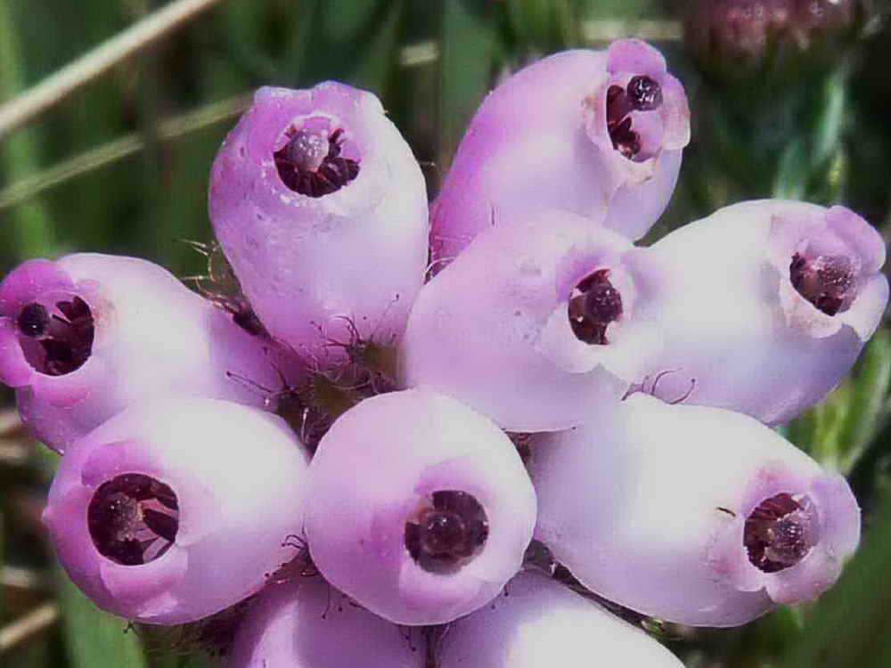
Taken for the form of the leaf for thefollowing photo ..... cross-leaved heath .....
The flowers are a lighter colour compared to Bell Heather ..... this is Cross-leaved Heath .....

Same photo, enlarged.
MAP: Red = GPS satellite track of the walk.

Ordnance Survey © Crown copyright 2005. All rights reserved. Licence number
100047373.
Also, Copyright © 2005, Memory-Map Europe, with permission.
This walk was reached by driving a short distance north-east from Postbridge towards Moretonhampstead and parking on the left, in an old quarry, marked on the map by the yellow cross.
Statistics
Distance - 4.9 km / 3.05 miles
All photographs on this web site are copyright ©2007-2016 Keith Ryan.
All rights reserved - please email for permissions