

This walk: 2010-9-15. Bronze Age round house, hut circle, Sharpitor, Fox Moth caterpillar, Steven Spielberg film company, Leeden Tor, Sweltor Quarry, dung bonnet toadstool, cist, ponies, Ingra Tor, Western gorse, Ingra Tor quarry, disused railway track, Ingra Tor Halt station platform, cattle creep, Bronze Age enclosures/pounds.
Walk details below - Information about the route etc.
Other walks in this area: 25 Feb 2009, 27 Aug 2010,
Examining a round house (hut circle) from the Bronze Age, with Sharpitor and the car park in the background.
A row of four hut circles - see next image .....

A Google Earth aerial view of the area, the hut circles can be ceen clearly near the centre of the image.
Another hut circle further up the slope.
Fox Moth caterpillar (common during July-October), up to 8 cm / 3 inches in length. Heather, bramble, and bilberry are among its food plants. It will be fully grown by the autumn. It will then hibernate, to emerge next spring without feeding, pupate in March/April and be on the wing in May. Click here for: a photo of an adult.
Marquees of the Steven Spielberg film company making the War Horse near Gutter Tor. The Scout Hut is off the left edge of this photograph.
Leeden Tor, SX 5633 7183, elevation 379 metres (1243 feet) - although the smooth summit of the hill is 10 metres higher.
The rock piles of Leeden Tor.
Part of Leeden Tor.
Another part, another view.
As previous caption.
Hugh atop his first tor of the day - Leeden Tor.
Roger, with a rock pile left (Leeden Tor) and Sharpitor (centre).
I must just like photographing Dartmoor's tors!
Looking across to Swelltor quarry.
Coprophilous fungus: a dung bonnet, Bolbitius vitellinus.
Almost concealed entrance to the cist at SX 55872 72093 ..... the capstone is present but is believed to have been broken into possibly three parts by labourers a long time ago.
Showing the size of the cist .....
Caption competition
You don't come out until you promise to buy a 'round' .....
Three nearby ponies, just chewing the cud.
Ingra Tor, SX 555 721, elevation 339 metres (1112 feet), seen from the direction of Leeden Tor.
Still talking about the cist and its prominent mound/cairn and its circle of retaining stones, largely covered by the ground.
Bridge at SX 5628 7246, over the disused railway track to Princetown (Plymouth & Dartmoor Railway superceded by the Great Western Railway).
c
A bush of Western Gorse, Ulex gallii, taken for its attractive appearance of colours.
Ingra Tor .....
Hugh atop his second tor of the day (Ingra Tor)!
A feature on Ingra Tor.
Looking down on the entrance into Ingra Tor quarry, with the platform of Ingra Tor Halt just across the old railway.
Looking into Ingra Tor quarry.
All that is left of Ingra Tor Halt railway station, the concrete platform - although there are a few old wooden railway sleepers nearby.
Criptor Farm with King's Tor behind.
Railway bridge over a "cattle creep" close to the quarry, so animals could "cross" the railway.
View under the bridge, towards King's Tor ..... note the old railway line now doing service as a fence post .....

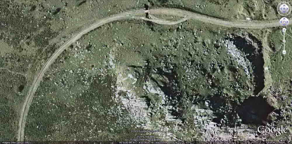
A Google Earth image showing Ingra Tor quarry at far right, the "cattle creep" bridge at top centre and the faint image of the old PDR track contouring around the more obvious GWR track at left third of the image. The GWR did not follow precisely the same route as the earlier PDR route.
Looking back at Ingra Tor.
House, "Routrundle", being restored at SX 5540 7170 .....

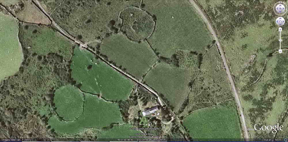
Two circular Bronze Age pounds/enclosures seen from the air, near the house that is being restored - visible at centre bottom in this image.
MAP: Red = GPS satellite track of the walk.

Ordnance Survey © Crown copyright 2005. All rights reserved. Licence number
100047373.
Also, Copyright © 2005, Memory-Map Europe, with permission.
This walk was accessed by parking on the B3212 road between Yelverton and Princetown, at the car park marked by the yellow cross on the map. The P symbol on the map is on the opposite side of the road to where the car park actually is - there are two car parks, seen in the Google Earth aerial photo above - the 3rd photo from the top. The parking area is 4.9 km from Yelverton.
Statistics
Distance - 4.81 km / 2.99 miles