![]()


This walk: 2010-8-4. OPB - Okehampton Parish Boundary stones, Cullever Steps, ford, Black-a-ven Brook, East Okement/East Ockment River, stepping stones, Scarey Tor, wooden wedge rock splitting, unfinished mill stone, East Bowden or Higher Halstock farm, Tarka Trail, Belstone Tor, Nine Stones, Irishman's Wall, cairn circle, kistvaen, pixies' or devil's matchsticks, WD stone.
Walk details below - Information about the route etc.
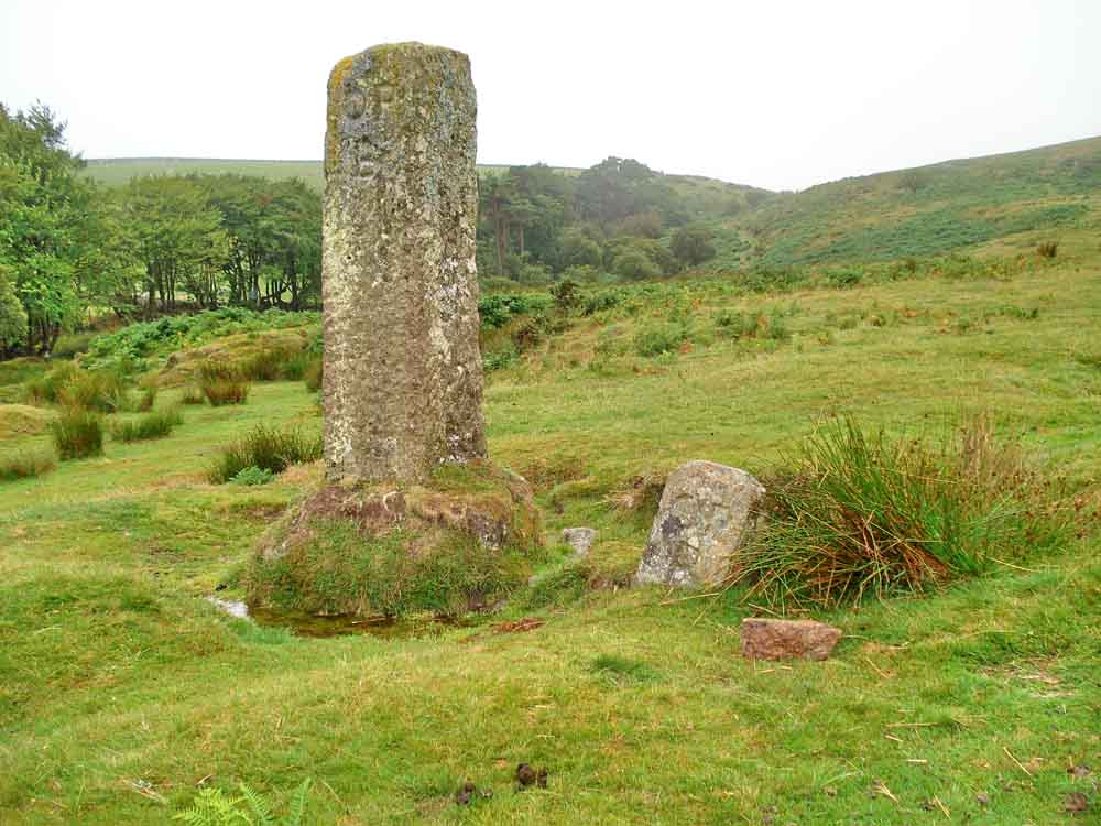
Two "OPB" - Okehampton Parish Boundary stones down the hill from the car park, near Cullever Steps ..... one story was that the short one was as tall as the tall one but was set in the soft ground .....

Ford at Cullever Steps over Black-a-ven Brook, looking east, one of two fords here ..... this view is towards the second ford which crosses the East Ockment River .....

Looking back at the first ford from the other side .....

Cobbled track to the second ford .....

Paving stones in the ford - this was done to protect this early military road from damage when heavy horse-drawn field guns and limbers were driven through (there is mention of this here, half-way down the page: try CTRL+F, "guns").

Stepping stones beside the ford.

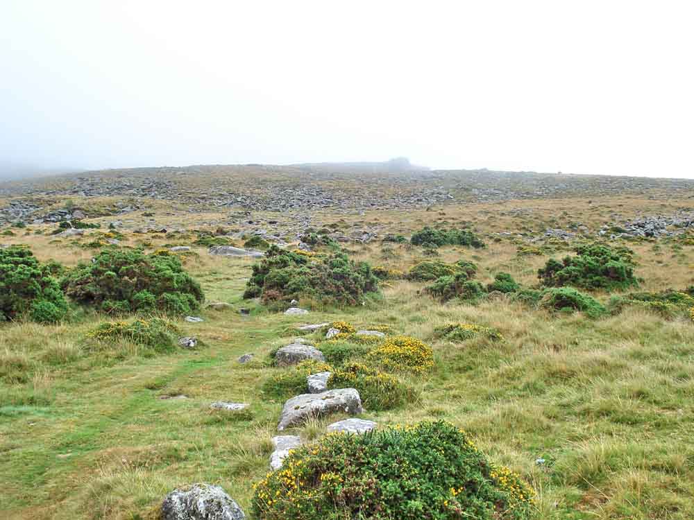
Scarey Tor, SX 6066 9230, aka Skurry Tor and Skir Tor, elevation 365 metres (1197 feet) .....

As previous photo .....
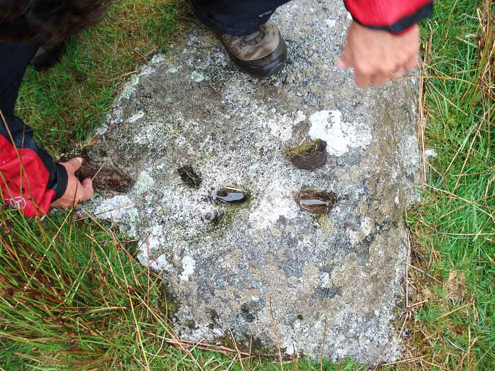
Nearby, at SX 60702 92458, a stone in the ground that someone attempted to cut by the old wooden wedge method - where grooves are cut, wedges inserted, soaked in water and left overnight to expand and split the rock .....
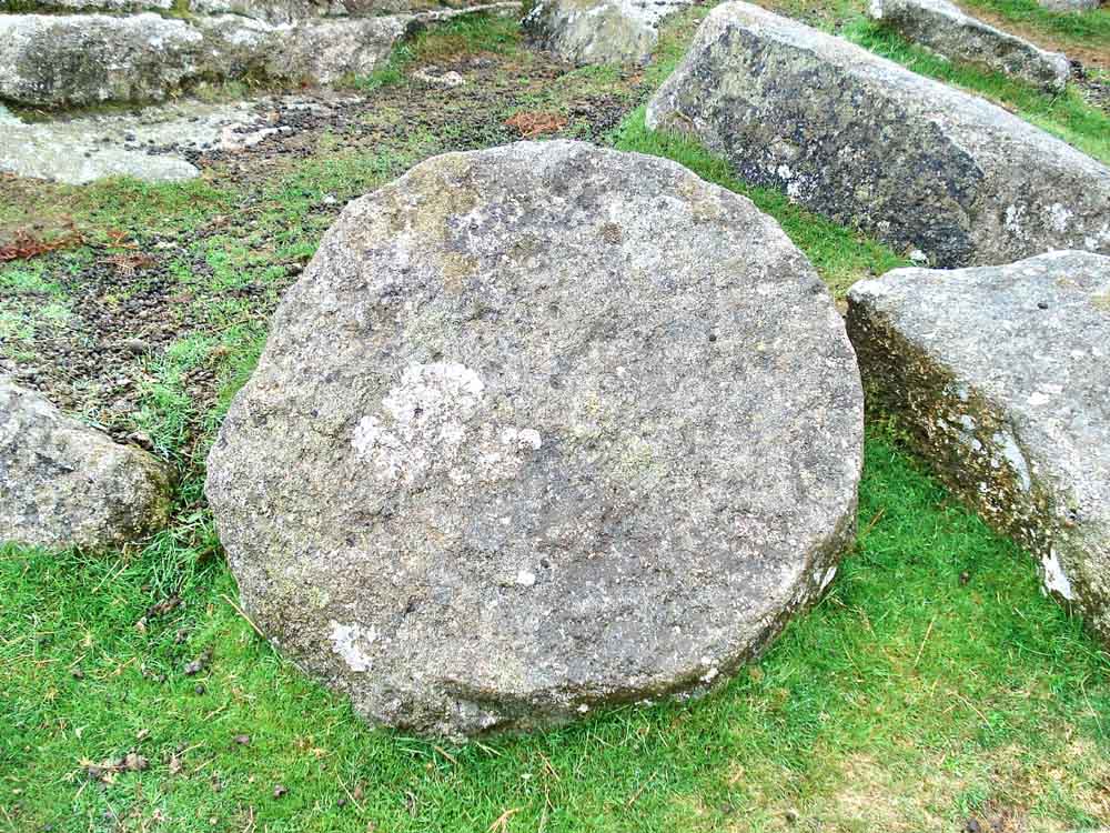
An unfinished millstone on Scarey Tor .....

Our intrepid explorer scales yet another of Dartmoor's tors, not so much a "Munro" - more an "Izzie"!
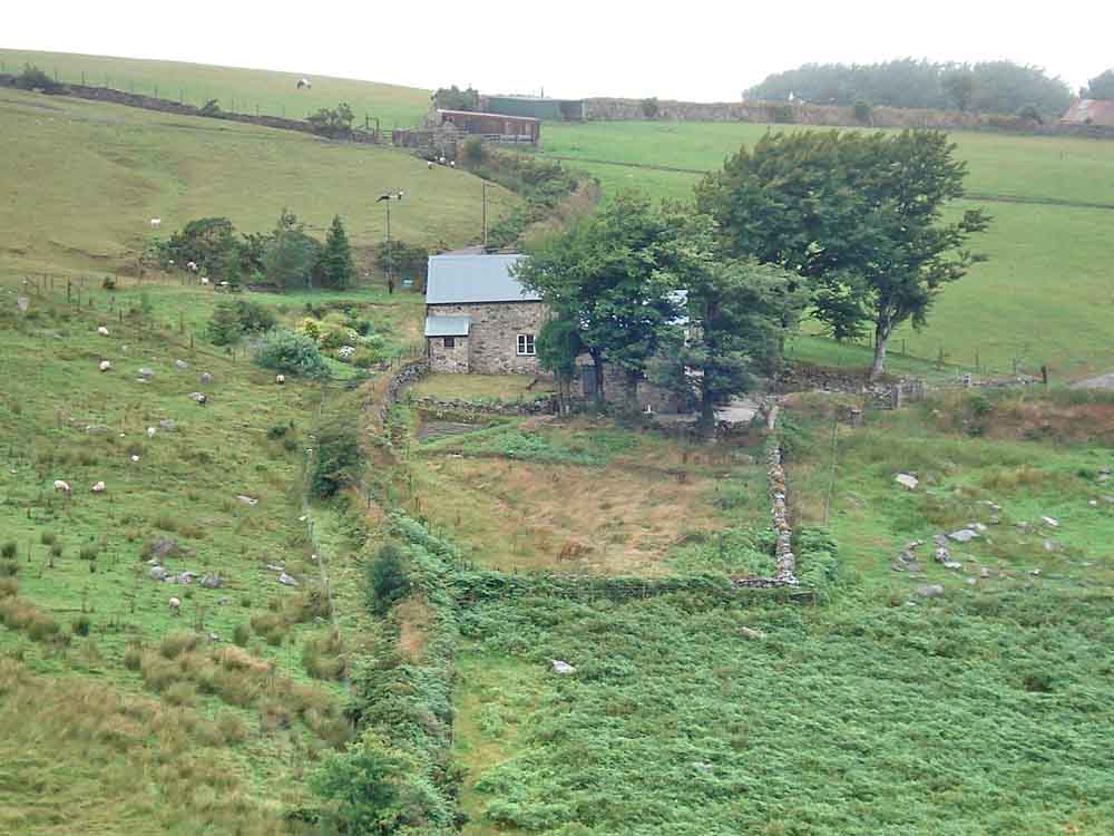
Zoomed view to East Bowden or Higher Halstock farm.

Another mark of the Tarka Trail, a long distance path based on the tale of Tarka the Otter (another was seen on the 21 Jul 2010 walk).

Belstone Tor, SX 614 920, elevation 479 metres (1571 feet). The cloud here was very low so the rain didn't have too far to fall .....

Nine Stones cairn circle, not visited since 21 Jul 2010, "when we had a proper walk" ..... there are stories of nine maidens, seventeen brothers etc. It is said that everytime you count the stones you get a different number - I counted twenty-two stones, with a few more flat or buried in the ground ..... the original story is about nine maidens who danced here on the Sabbath and who were turned to stone and compelled to dance at noon every day, 'tis said ..... Apparently, the St Michael's Ley line passes through the circle; see also a Legendary Dartmoor link and The St Michael Line.

From Nine Stones to Belstone Tor.
Irishman's Wall, looking up the hill .....

Irishman's Wall, looking down the hill.

Cairn circle at SX 6077 9196, where the kistvaen (cist) is in poor cindition.
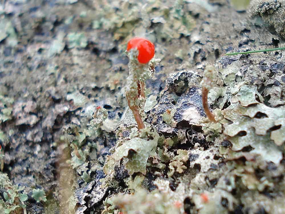
Believed to be the red tipped fruiting body of Cladonia floerkeana, known locally as Dartmoor matchsticks, pixies' matchsticks or as devil's matches - this species is very like a matchstick. Alternatives would be C. diversa (fruiting stalk is branched), C. macilenta (red tip is very narrow compared to diameter of the stalk) and Dibaeis basomyces (fruiting bodies are short and fat). Several Cladonia species can be seen here.

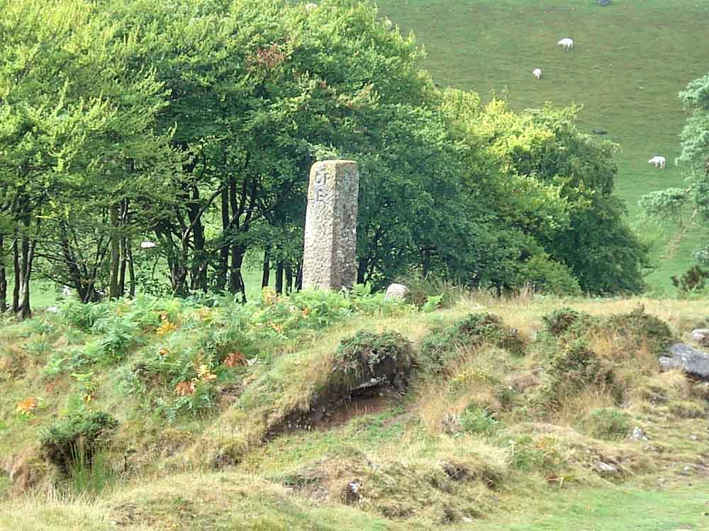
War Department marker stone. Dave Brewer (2002), in Dartmoor Boundary Markers (page 212), discussing the bounds of the original 80 acres granted to the War Department mentions eight numbered stones and "There are at least two others in Belstone parish simply inscribed "WD". Above the right bank of the East Ockment River, each of these stones appear to be one half of a granite window sill, at SX 6070 9233 and SX 6075 9210". The stone above appears to be the latter because it lies close to the track of our walk and near the end of the walk. It has an unusually shaped back as if it might have been a window sill.
Another view of the OPB stones seen at the start of the walk, as we near the car park.

Large black slug, Arion ater, of the Snailey House variety. Caution - the link leads to a long old tale! This is a round-backed variety rather than a keel-backed slug (the breathing pore was near the front of its mantle rather than at the back).

A splash of yellow and purple (gorse and heather).

Looking up the Black-a-ven Brook valley .....
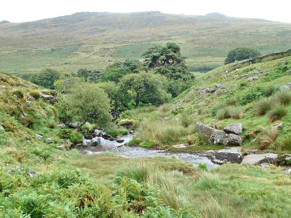
Looking down the Black-a-ven Brook.
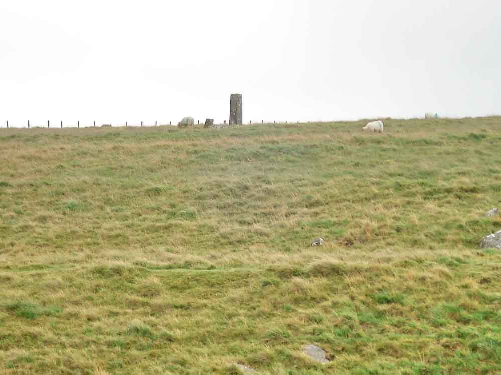
Zoomed view to another pair of OPB stones, at SX 6014 9190.
MAP: Red = GPS satellite track of the walk.

Ordnance Survey © Crown copyright 2005. All rights reserved. Licence number
100047373.
Also, Copyright © 2005, Memory-Map Europe, with permission.
The walk was accessed by following Station Road, from the traffic lights in the centre of Okehampton, all the way past the military camp to the parking area at SX 6002 9197, marked by the yellow cross on the map above.
Statistics
Distance - 4.1 km / 2.55 miles.
All photographs on this web site are copyright ©2007-2016 Keith Ryan.
All rights reserved - please email for permissions