![]()


This walk: 2009-8-5. Holming Beam, firing range warning signs, Cowsic River, Lydford Tor, Beardown Tors, Crow Tor, Devil's Tor, Longaford Tor, Higher White Tor, river bridge, Long Plantation, Princetown, stable for Range Officer's pony, Devonport Leat take-off point, Sundew, cross-leaved heath, bell heather.
Walk details below - Information about the route etc.

Firing range warning sign at the car park.

Looking up the track with the Cowsic River valley to the right.

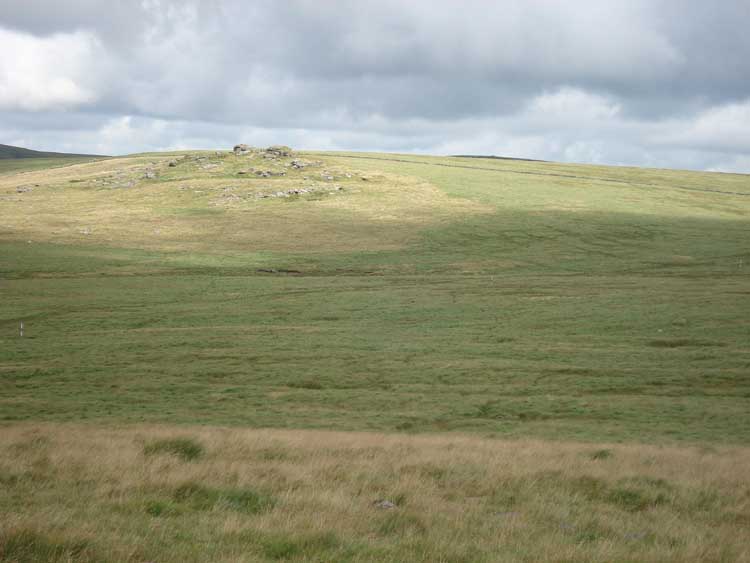
Looking across the Cowsic Valley to Beardown Tors, after the turn right in the track.

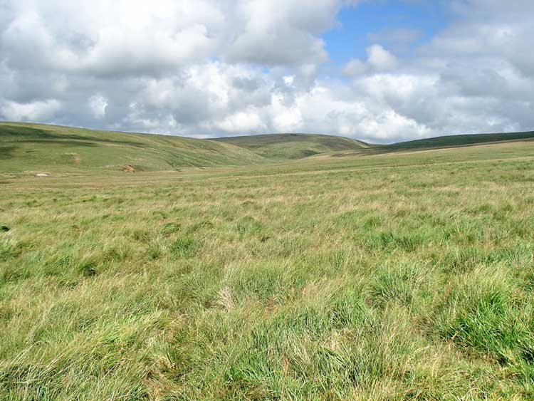
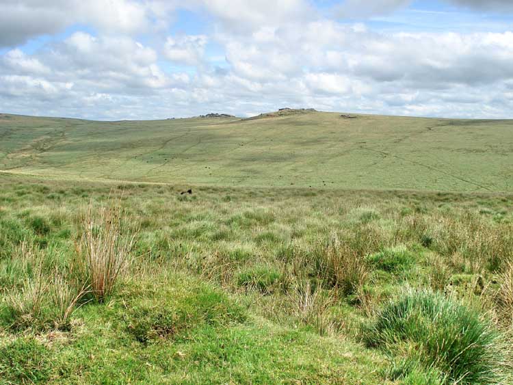
The Cowsic valley.
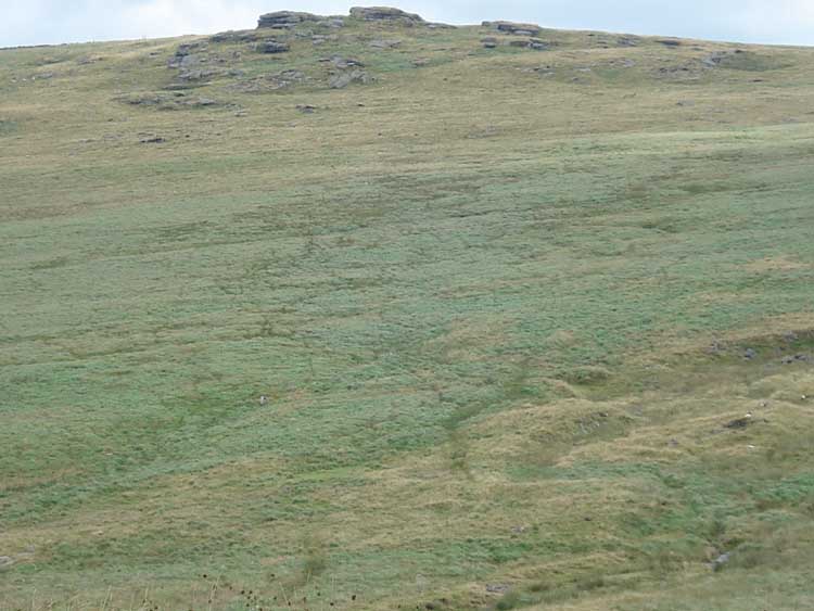
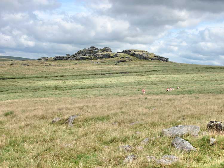
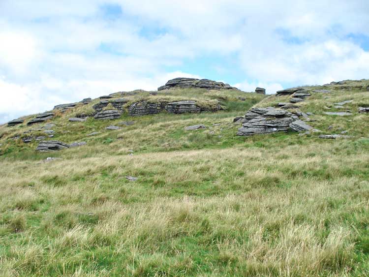
Lydford Tor, elevation approx. 503 meters (1650 feet).

Part of Beardown Tors, elevation 500 meters (1640 feet).

Another view up the Cowsic valley.
The nearer part of Beardon Tors again.
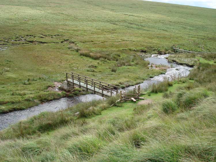
Bridge over the Cowsic at SX 5944 7711.

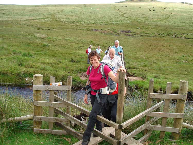
Moor Strollers crossing the Cowsic.
Looking north, up the Cowsic River from the bridge .....
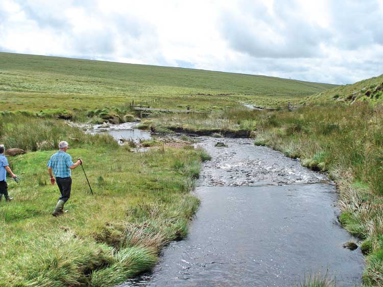
..... and south, down the river.

Looking back at the bridge.
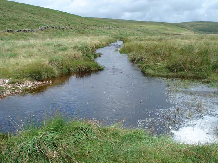
A bend in the river just before it reaches the bridge.

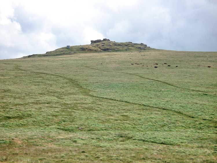
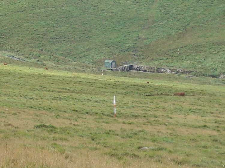
A view of Beardown Tors showing the range clearer's hut - they have to round-up and remove livestock from the range before "live" firing can start.

Looking back at the track we came down.

View of Princetown, with North Hessary Tor on the right. The car park is approximately centred in the photo at the top of the hill, by the Long Plantation, .

Beardown Tor again, looking brooding.

View to Rough Tor, elevation 547 meters (1794 feet) with Crow Tor (right), elevation approx. 488 meters (1601 feet).
Approaching the nearer part of Beardown Tors, showing the stable for housing the range clearer's pony.
Looking back at the first part of Beardown Tors en route to the second outcrop.

The second part of Beardown Tors with the flag pole.
Looking across the Crow Tor.

Looking across the next valley, with the West Dart, towards Higher White tor, centre 520 meters (1706 feet) with Longaford Tor, right 501 meters (16463 feet).

Sign at the flag pole on Beardown Tors - what a view!

Low-angle photo by a low rock pile looking towards Lydford Tor.
Another view of part of Beardown Tors.

Zoomed view of Princetown again, with North Hessary Tor on the right.
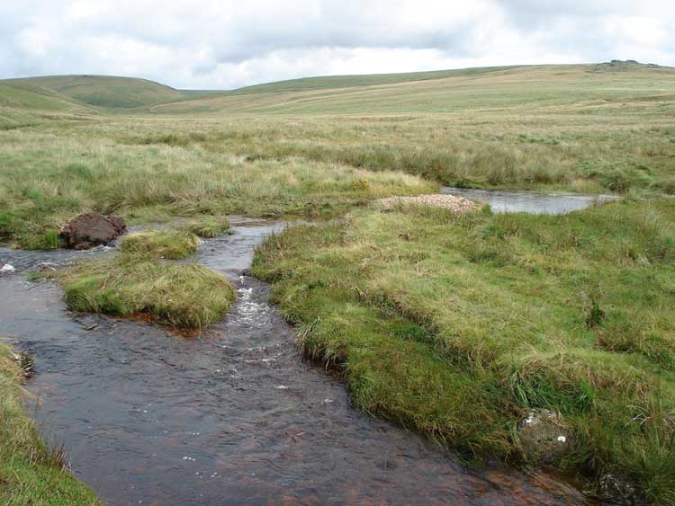
Looking down at the Cowsic take-off point for one of the arms of Devonport Leat.

Cows passed en route.
A different viewpoint up the Cowsic valley.

Insectivorous Sundew plant (Drosera) .....
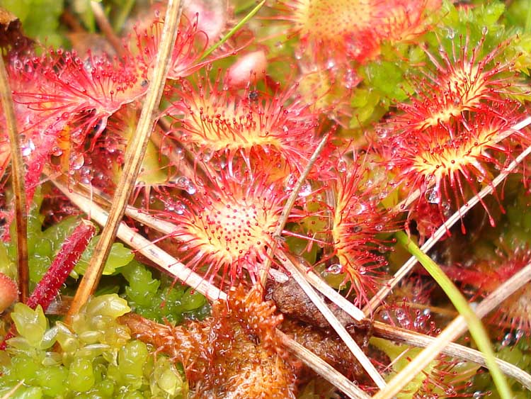
..... in close-up.

Cross-leaved heath (Erica tetralix).

Bell heather (Erica cineraea).
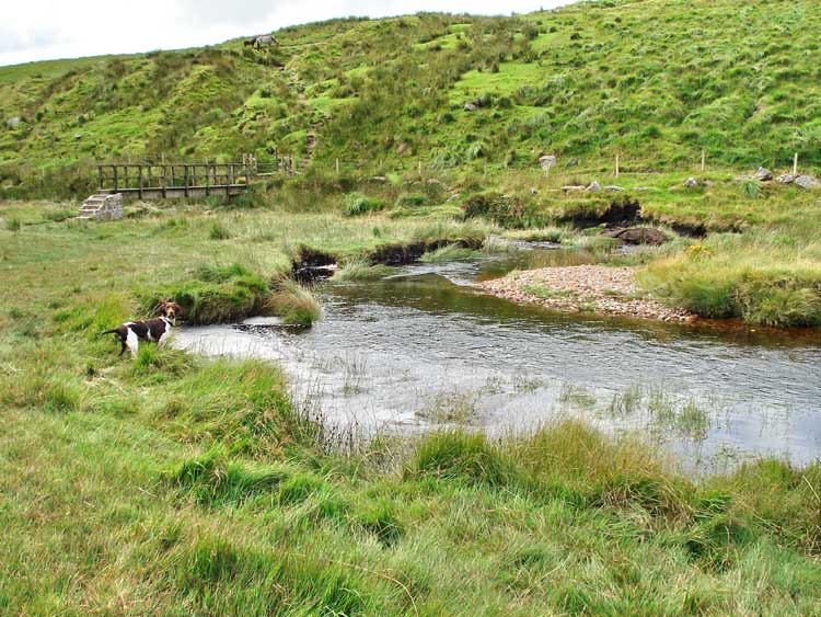
Back to the bridge .....

..... pony and foal waiting for us.

Moor Strollers doing what Moor Strollers do .....
...... still.

Inquisitive foal .....

..... in close-up.

Walking back up the track with Beardown Tors in the background.

..... as previous.

..... as previous.
Beardown Tors under a brightening sky .....
|
Dartmoor CAM
Movies |
|
|
Tip - press F11 (at top of keyboard) to see Full Screen view.
Quicktime movie player: you may also need to
press F11
to see the Play icon u
at the bottom of the movie image if it comes up in the "Quicktime" movie
player.
Windows
Media Player: F11
also gives a Full Screen view of the movie. Press again to cancel.
Press F11 again to
return to Normal View
to get back to the "Back" button t on the browser to continue browsing.
Turn up the sound - hear
the wind! |
|
MAP: The red line is the route walked.
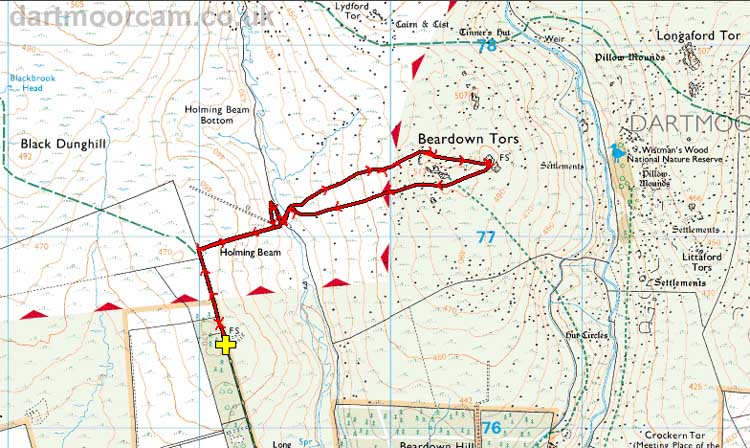
Ordnance Survey © Crown copyright 2005. All rights reserved. Licence number
100047373.
Also, Copyright © 2005, Memory-Map Europe, with permission.
Access to the walk was very easy. The B3357 from Two Bridges towards Tavistock is followed for a kilometre, as far as the right-turn beside the Long Plantation. Parking was at the yellow cross symbol.
Statistics
Distance - 4.79 km / 2.98 miles.
All photographs on this web site are copyright ©2007-2016 Keith Ryan.
All rights reserved - please email for permissions
