![]()


This walk: 2009-7-15. Princetown, drinking fountain, structure from the overhead ropeway for transporting logs from Brimpts, Blackbrook River, Devonport Leat, Batchelor's Hall, sheep, Conchie's Road, Crock of Gold cairn circle and cist, Blakey Tor East cist, Blakey Tor.
Walk details below - Information about the route etc.

Drinking fountain beside the Princetown-to-Two Bridges road.
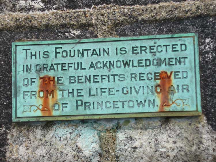
Notice at the top of the fountain.

Inscription on the fountain.

Fountain head.

An unusual device just off the road, thought to be part of the overhead rope-way for transferring logs from Brimpt's to the railway at Princetown.
Information from a later email:
I suspect others will have told you that the remains of the iron gateway shown in one of your photos was from the level crossing at Dousland.
The remains of the G.W.R. level crossing gate adjacent to "Sunnyside": Jonathan Stones tells me that he was told by 'Sonny' Williams (an old farm hand) that he helped one Val Forder (sometime tenant of Sunnyside when a Duchy Farm) to transport the said gate from its original working position at Dousland. It's second life was as a 'cattle crush'.The ropeway bringing timber from from Brimpts Plantation, powered by an engine at Moorlands Farm, ended nearby but I am told nothing visible remains - though many will remember old photographs in the Plume of Feathers in James Langton's time.

Another unusual feature - a training device.

Looking east, down on the Blackbrook River that runs into the West Dart River.

Looking south, along Devonport Leat towards the nearby trees ......

..... looking north from the same spot, towards where the leat passes under the B3212 and runs towards the prison.

Batchelor's Hall, now a YMCA facility. Originally built by Sir Thomas Tyrwhitt ... it was then used for naphtha extraction: from Dartmoor peat on the Legendary Dartmoor web site:
"Another area of commercial peat extraction was in the Greena Ball / Holming Beam / Fice's Well area which is located above Princetown. Peat has an average content of 65% volatile matter and when distilled it is possible to obtain naphtha, so with this in mind Peter Adams and Jacob Hall started the British Patent Naphtha Company in 1844. It was initially based at Bachelor's Hall but in 1846 moved to the empty Princetown Prison. The peat was brought down from the ties in horse drawn wagons on a tramway, parts of which can still be seen today. This was then distilled to extract the naphtha oils which were used to produce candles, mothballs and gas for lighting."

.... a zoomed view.

Rounding the bend .....

Shorn sheep .....

..... and again.

Conchie's Road, so-called because it was rebuilt by conscientious objectors in WWI.

Just a view to Moorlands Farm.

The first cist to be seen today, at SX 61284 73075 � 5 metres. This is the Crock of Gold cairn circle and cist. The removed cap stone is to the left, some stones of the circle that retained the earth covering of the grave are seen and the cist is behind .....
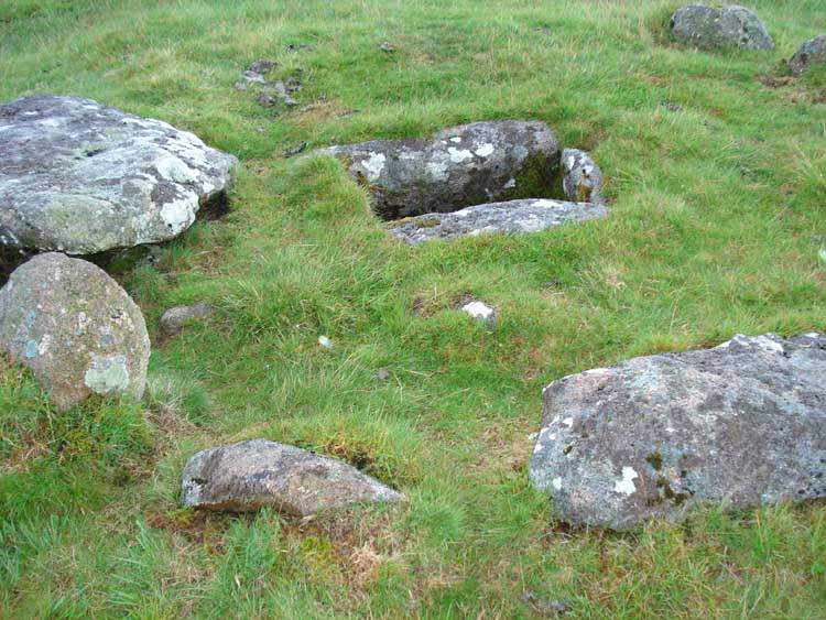
..... a view of the cist (stone box grave) with the cap stone to the left.

An animal feeder.
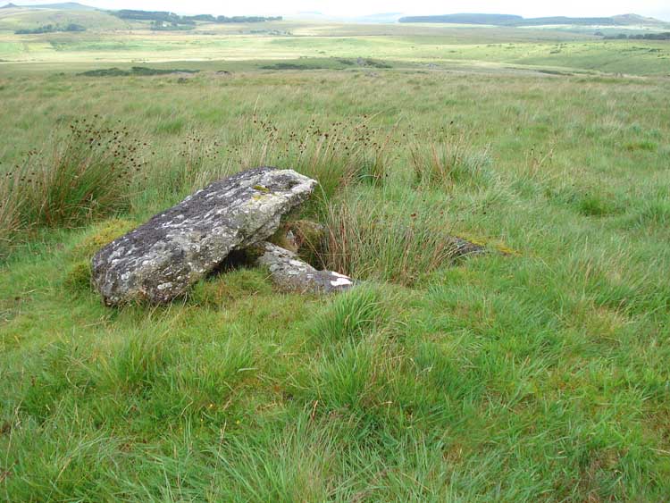
A second cist, at SX 61310 73558 � 4 metres, Blakey Tor East cist. Another cist, Blakey Tor West cist, is located at SX 61237 73555 � 4 metres, 80 metres away, although we didn't visit it (however, see this page from the following day).
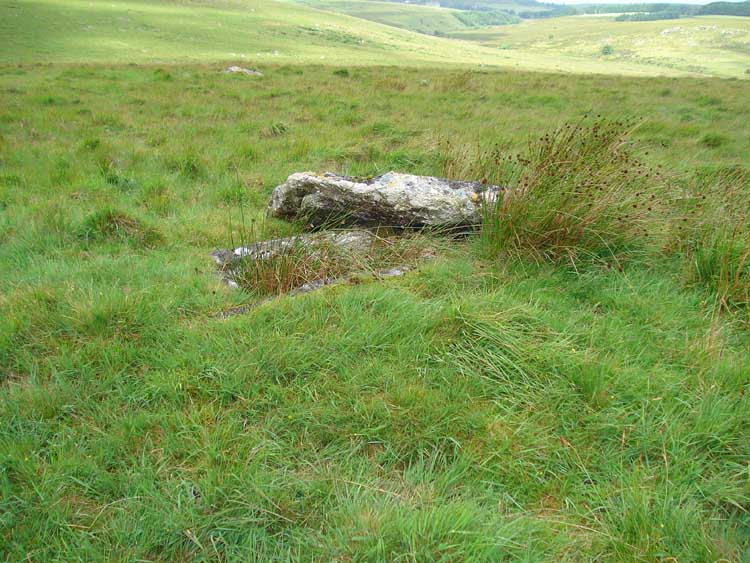
..... another view.

Blakey Tor, SX 6130 7366.

Blakey Tor again.

View from Blakey tor .....

..... and "zoomed".
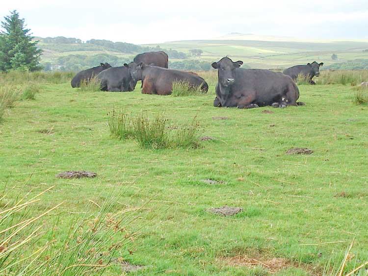
Heifers taking a rest, watching us go past .....
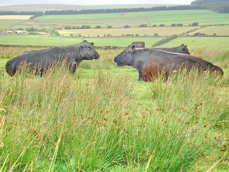
"......... and I'M telling YOU ..... it WAS the Fertility butterfly they were looking for ....."
For those who want more, this walk was repeated the following day to visit two further cists, on this page.
MAP: Red = GPS satellite track of the walk.
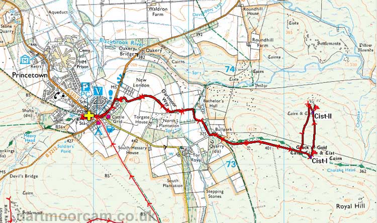
Ordnance Survey © Crown copyright 2005. All rights reserved. Licence number
100047373.
Also, Copyright © 2005, Memory-Map Europe, with permission.
This walk was approached very simply by parking in the centre of Princetown, at the P symbol / yellow cross on the map.
Statistics
Distance - 7.1 km / 4.4 miles.
All photographs on this web site are copyright ©2007-2016 Keith Ryan.