![]()


This walk: 2008-8-22. Burrator, Norsworthy Lane, blowing house with mould stone, potato cave, River Meavy, potato cave, bridges. old farms, dolls head, aqueduct, sluices for water flow control, crazy well Pool, restored cross, old tin mine, worked stone.
This walk is taken from the Dartmoor Rescue Group, Plymouth Section, book Walking in Southern Dartmoor, Walk 11, where it is called Mines, Farms, Water and Forest.
There are two pages of photos from this walk - click here to see the second page.
Stereo - due to the work involved and the lack of interest, stereo pages are being suspended for the present.
Walk details - Information about the route etc. are on the second page of photos from this walk, as is the map etc of the planned route and the actual track followed.

To reach this old tinner's blowing house, go about 50 meters up the track (which is Norsworthy Lane) from the car park at Norsworthy Bridge (far end of Burrator Reservoir from the dam) towards Crazy Well Pool. Turn left at the junction and look for the second stile (GPS location: SX 51782 69600 � 5 meters) on the left after about 110 meters. The River Meavy runs right alongside the site. The mould stone (photo below) can be seen left of centre in the photo above.

Mould stone for casting molten tin into ingots for transport away from the site by pack pony or mule.

Three mortar stones on the floor near the mould stone (at rear). These bear depressions from where the stamps ground the tin ore prior to smelting in the Blowing house. A fourth mortar stone lies in the wall, right of the mould stone, around the corner.
Leather Tor Bridge, at SX 56905 69953, apparently built by two men for �27. 10s, we were told by a passing walker.

Signpost seen a little further up the track on the way to the potato cave, at the River Meavy end of Raddick Lane.

Manmade structure that may be the remains of another blowing house (there is one here somewhere), although it may have been part of old farm walls (Riddypit Farm?).

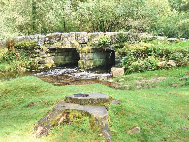
The potato cave entrance. It is reached by climbing the stile (at SX 57075 70314) on the right a few meters after crossing the steam that now runs across the road. The cave is just a few steps away from the stile, towards the left. This area is now very overgrown compared to 25-30 years ago when our children were small!
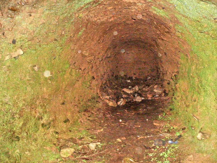
Looking to the back of the cave (almost 10 meters deep?) - the cave is very dark inside so take a good torch. This flash photo is digitally enhanced.
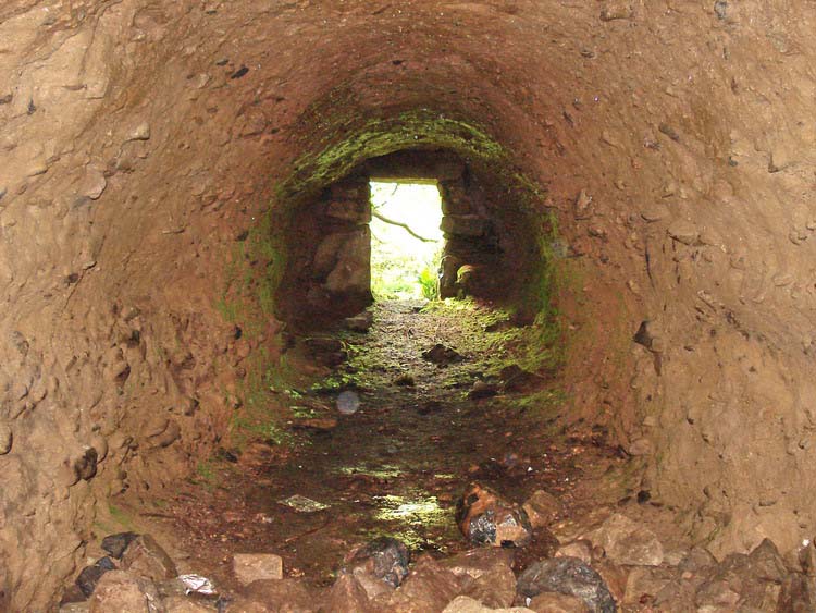
Enhanced flash photo taken from the back of the cave.
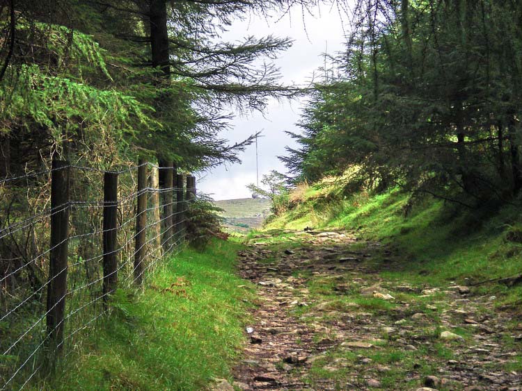
A view of North Hessary Tor TV mast, seen from the end of the lane through the wood.

The two makeshift metal "bridges" over the River Meavy and other streams at SX 57150 70863. The Meavy is running in from the left, into the woods which are out of sight on the right.

Walking a few meters north-westwards from the River Meavy brings you to the ruins of Stanlake Farm, abandoned around 1920.

Stanlake Farm scene, looking east.

Having walked up the slope from the Meavy, alongside the edge of the wood, this is the next footbridge over Devonport Leat, at SX 56957 71023.

Walking up the slope from the leat at the next footbridge, a gatepost that was part of Stanlake Farm. Just beyond, on the map, are hut circles but they were badly overgrown and not visible on this occasion - due to bracken!
Possible part of an overgrown hut circle, see previous photo.

The famous Red Indian head (a porcelain plaque) now damaged. More information about this curiosity can be seen on the Legendary Dartmoor web site, here. This has to be viewed from the north bank of the leat. Two locating landmarks are shown in the next two photos - a nearby tree and the view across the leat .....

..... looking across the leat, this wall is seen in this orientation .....

..... and looking at the Red Indian's head, this tree is directly behind you. Alternatively, you can count the number of blocks from a footbridge as described in the account on the Legendary Dartmoor web site, see above.

The pipe at the bend in the leat below the aqueduct, at SX 57287 71395. The view is looking up the River Meavy valley. We didn't check this point but presumably this piped water is from the Meavy and feeds directly into the leat. This seems a little odd because both the river and the leat feed into Burrator Reservoir but perhaps it all has to do with managing flow. Upstream of this in the leat are four sluices, all of which divert flow out of the leat and into the valley. Hart Tor is in the distance.

Devonport Leat, tumbling down the side of Raddick Hill to the aqueduct over the River Meavy.

A view of the sluice on the aqueduct.

Another view of the aqueduct sluice, showing the run-off channel down to the River Meavy. Walkers can be seen across the leat after the bend where the pipe is located.

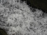
Tumbling water .....
|
Dartmoor CAM
Movies |
|
|
Tip - press F11
(among the keys at the top of your keyboard)
to see the Full Screen view.
Also, you may need to press F11
to see the
Play icon
u
at the bottom of the movie image
if it comes up in the "Quicktime" movie player.
|
|
|
Turn the sound up on your
computer!
|
|
Click here to see the
second page of photos from the
walk.
All photographs on this web site are copyright ©2007-2016 Keith Ryan.
All rights reserved - please email for permissions